Visual Simulations

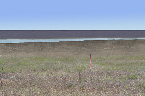
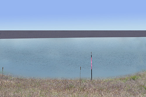
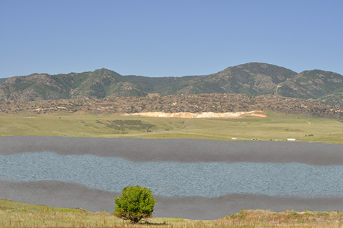
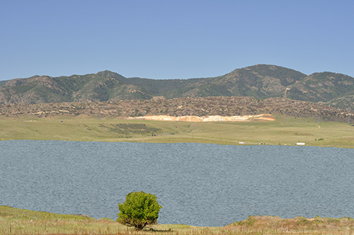
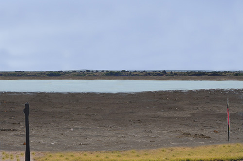
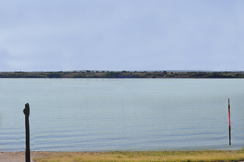
The Reallocation Project would destroy much of Chatfield State Park’s riparian forest. Water levels in Chatfield Reservoir would reach or exceed the target level (5444 ft.) about a sixth of the time; water would cover low-lying areas cleared of forests and some of the remaining forests at higher elevations. Another sixth of the time, water levels would be close to or lower than the current target level (5432 ft.); mudflats would cover the low-lying areas now covered by forests. The rest of the time, water levels would fluctuate between these two extremes.

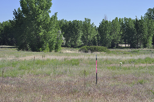
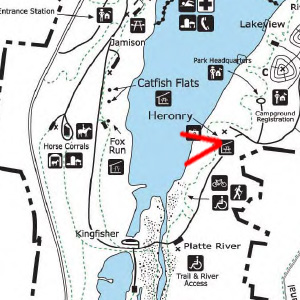
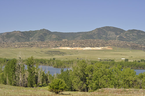
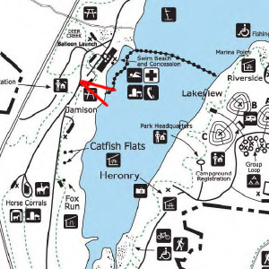
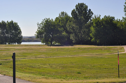
Images on this page show current conditions and attempt to show what the same areas might look like at low and high water levels. There are four images for each case: a small map with red lines that approximate the camera’s view, an original photo, and simulated images of what a post-reallocation photos might look like at low and high water levels. Stakes in photographs and simulated images indicate the proposed target water level. During periods of flooding, water levels could be higher.

Plum Creek Area
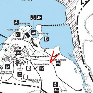
View for Plum Creek Photo Simulation
Approximate View for Plum Creek Area Photo Simulations
Plum Creek Area -- Current Conditions
Plum Creek Area — Current Conditions
Plum Creek Area -- Simulated Post-Reallocation Low Water Conditions
Plum Creek Area — Simulated Post-Reallocation Low-Water Conditions
Plum Creek Area -- Simulated Post-Reallocation High-Water Conditions
Plum Creek Area — Simulated Post-Reallocation High-Water Conditions

 Heronry Overlook

Approximate View for Heronry Overlook Photos and Visual Simulations
Approximate View for Heronry Overlook Photo Simulations
Heronry Overlook -- Current Conditions
Heronry Overlook — Current Conditions
Heronry Overlook -- Simulated Post-Reallocation Low-Water Conditions
Heronry Overlook — Simulated Post-Reallocation Low-Water Conditions
Heronry Overlook -- Simulated Post-Reallocation High-Water Conditions
Heronry Overlook — Simulated Post-Reallocation High-Water Conditions

Looking East from Perimeter Road
Approximate View for Photo Simulations Looking East from Perimeter Road
Looking East from Perimeter Road -- Current Conditions
Looking East from Perimeter Road — Current Conditions
Looking East from Perimeter Road -- Simulated Post-Reallocation Low-Water Conditions
Looking East from Perimeter Road — Simulated Post-Reallocation Low-Water Conditions
Looking East from Perimeter Road -- Simulated Post-Reallocation High-Water Conditions
Looking East from Perimeter Road — Simulated Post-Reallocation High-Water Conditions